
India has formally identified 27 places and features in Arunachal Pradesh by their standard names on the official Indian map, a move aimed at countering China's repeated attempts to rename locations in the state. This action reinforces India's stance that Arunachal Pradesh is an integral part of the country, despite China's "fictitious names" for the region it calls Zangnan.

China has declared India's move to identify 27 places in Arunachal Pradesh by their standard names as "illegal, null and void," reiterating its claim over the region it calls Zangnan. India has consistently rejected China's renaming attempts, asserting Arunachal Pradesh as an integral part of India.
In July, tension emerged in Taksing, a remote village in the Upper Subansiri district of Arunachal Pradesh after locals sighted PLA soldiers.

Here are constituency-wise results mapped for the Arunachal Pradesh and Sikkim assembly elections.

China has long coveted Arunachal Pradesh, which it calls Southern Tibet. But, as Venkataraghavan Subha Srinivasan explains, in 1947, the present state of Arunachal Pradesh constituted the North East Frontier Tract of Assam. When India adopted its Constitution on 26 January 1950, NEFT became 'a separate politico-administrative entity' although it was constitutionally still a part of Assam. Its administration was brought directly under the President of India with the Governor of Assam acting as his agent. A revealing excerpt from his book The Origin Story of India's States.

It is very unfortunate that China has decided to proceed with the controversial mega hydropower plants(despite the apparent opposition of many scientists in China). Why is Delhi silent about the development? asks Claude Arpi.
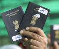
An Arunachal Pradesh woman was allegedly detained at Shanghai airport for nearly 18 hours after Chinese immigration officials refused to recognise her Indian passport, claiming Arunachal Pradesh is part of China.
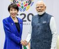
If they act now, they can reshape the strategic map of Asia without firing a shot. If they wait, the next opportunity will come only after a serious Taiwan Strait incident -- by which time the price will be far higher, and the room for boldness far smaller -- the opportunity may well be lost by then. The question is no longer whether this can or should be done, points out Varun Arya.

China claims the northeastern Indian state of Arunachal Pradesh as part of South Tibet, which is firmly rejected by India.

'This is no longer a single-hazard problem; it is a cascading, multi-hazard problem. A landslide never occurs in isolation. This entire chain is the cascading effect of what looks, at first, like a single disaster.'

'China continues to perceive its relations with India through the prism of India-US relations, with the US using India to counter balance against China in the Indo-Pacific and beyond.'

In other words, what you see on Google Maps's India site is what India wants; what you see on Google Maps's China site is what China wants. So what does Google believe in? For that, you should visit their international site, http://maps.google.com, which shows what is the truth according to it (image alongside). It clearly shows Arunachal Pradesh as a disputed territory
India says the State of Arunachal Pradesh is its integral and inalienable part.

The US Trade Representative's office removed a social media post featuring a map of India that showed the entire region of Jammu and Kashmir, including Pakistan-occupied Kashmir, as well as the Aksai Chin region as part of Indian territory.
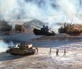
While tensions have eased at several friction points and mechanisms for managing the boundary have been reactivated, underlying differences persist. Disputes over naming practices in Arunachal Pradesh, continued infrastructure development on both sides, and unresolved questions regarding patrolling rights indicate that the structural gap remains, notes Dr Kumar.

Check out all the numbers here.
The Israel Defence Forces (IDF) on Saturday issued a new graphic showing Kashmir as Indian territory, rectifying their previous mistake.

The United States said it does not endorse the new "controversial" Chinese map on its passport, which depicts certain disputes territories as its own, causing a major diplomatic row in the region including with India.

India on Tuesday lodged a strong protest with China over its so called 'standard map' laying claim over Arunachal Pradesh and the Aksai Chin, and asserted that such steps only complicate the resolution of the boundary question.

The Chinese inference is that if the Chinese visa is embossed on an Indian passport, held by Indian citizens from Arunachal Pradesh, it may be tantamount to recognising Indian sovereignty over Arunachal Pradesh, states Rup Narayan Das.

'The whole of Ladakh knows that China has usurped our land'

In a statement, the BJP MP of Aarunachal East constituency said communities living beyond the McMahon Line share "deep civilisational roots with Bharat", and it's time for India to reclaim the regions "that are rightfully part of our country".
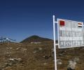
China on Wednesday defended its move to release a new 'standard map' for 2023 showing Arunachal Pradesh and Aksai Chin as part of its territory, saying that it is a 'routine practice' in accordance with its law and urged India to 'stay objective and calm' and refrain from 'over-interpreting' the issue.

China is distributing millions of controversial updated maps to its military in the first upgrade in 30 years, reportedly reinforcing its claims over Arunachal Pradesh.
The resolution also pushes back against People's Republic of China (PRC) claims that Arunachal Pradesh is PRC territory, which is a part of the PRC's increasingly aggressive and expansionist policies.
The resolution condemns additional Chinese provocations, including China's use of military force to change the status quo along the Line of Actual Control, construction of villages in contested areas, publication of maps with Mandarin-language names for cities and features in the Indian state of Arunachal Pradesh, and expansion of Beijing's territorial claims in Bhutan.

Want a detailed break-up of the winners and losers of Andhra Pradesh, Odisha, Arunachal Pradesh and Sikkim? Here's the verdict mapped out for you.

It was also learnt that Gautam Navlakha, a shareholder in NewsClick, remained involved in anti-Indian and unlawful activities such as actively supporting banned Naxal organisations and having anti-national nexus with Gulam Nabi Fai, an agent of Pakistan's ISI, it stated.

The Lokapriya Gopinath Bardoloi International Airport in Guwahati has inaugurated a new nature-themed terminal building, designed to handle 13.1 million passengers per year and serve as a key aviation hub for the northeast and a gateway to Southeast Asia.

For decades, the Siliguri Corridor was treated as a geographical vulnerability to be quietly managed. Today, it has emerged as a focal point of eastern geopolitics.

A controversy was kicked up on Thursday with China's state-owned television CCTV showing India's map without Jammu and Kashmir and Arunachal Pradesh while reporting on Prime Minister Narendra Modi's visit.

How does blatantly claiming Indian territory help to maintain 'peace in border regions', is a mystery that only China can explain, notes Claude Arpi.
The Chinese government has stirred yet another controversy even as Vice President Hamid Ansari is in Beijing to mark 60 years of the Panchsheel agreement. In a recent map, China has shown Arunachal Pradesh as its territory.
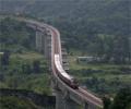
Projects about to be completed include the first rail connectivity projects in Meghalaya and Arunachal Pradesh, along with crucial gauge conversion between Rangpara and North Lakhimpur, which would connect Arunachal Pradesh to the rest of the country.

Unhappy over China showing Arunachal Pradesh and Aksai Chin as its territory in maps of the country on their new e-passports, India has retaliated by issuing visas, containing Indian maps including these regions as part of it.

A powerful senatorial committee on Wednesday is set to consider a bipartisan resolution to recognise Arunachal Pradesh as an integral part of India, pushing back against China's military aggression to change the status quo along the Line of Actual Control.

Joshi's reaction came after Gandhi termed as "very serious" the issue of China releasing a "standard map" that laid claim over Arunachal Pradesh and Aksai Chin, and claimed the neighbouring country has already taken India's land in Ladakh and Prime Minister Narendra Modi should speak on the issue.
Australia has withdrawn a map of India, posted on its immigration department website which omitted the border states of Jammu and Kashmir and Arunachal Pradesh, following strong protests from the Indian community in the country.

Though the Chinese find it necessary to oppose the visits of Indian leaders to Arunachal Pradesh, they want to keep the objections at a moderate level lest it cast a shadow on Narendra Modi's visit to China in May, says D S Rajan.

Reacting strongly to reports that China has in its recent map shown Arunachal Pradesh as its territory, India on Saturday said "cartographic depictions" do not change reality on the ground and asserted that Arunachal was an integral part of the country.
